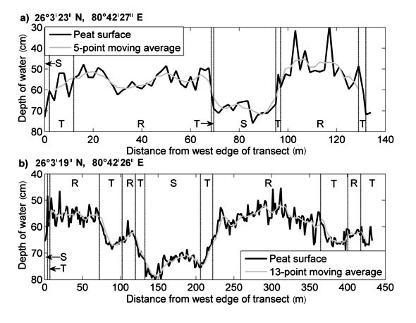
FIG. G1. Regions of ridge vegetation, slough vegetation, and transitional vegetation are denoted by R, S, and T, respectively. Transects run from east to west. The coordinates given in (a) and (b) denote the western-most point along the transect.
Appendix G. Peat surface topography across two ridge/slough transects in the best-preserved portion of the ridge and slough landscape in WCA-3A.
|
|
FIG. G1. Regions of ridge vegetation, slough vegetation, and transitional vegetation are denoted by R, S, and T, respectively. Transects run from east to west. The coordinates given in (a) and (b) denote the western-most point along the transect. |