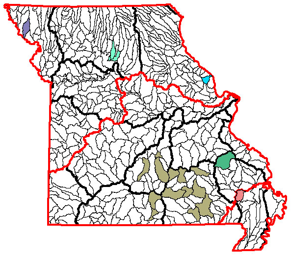
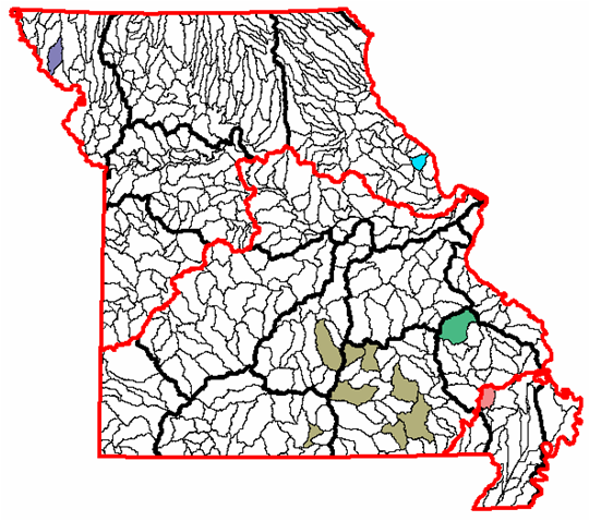
Appendix K. Maps showing the Aquatic Ecological Systems (AESs), colored by type, that have all stream size classes represented in GAP management-status 1 or 2 lands (Map A) and those that have all size classes represented as an interconnected complex (Map B).
|
|
|
|