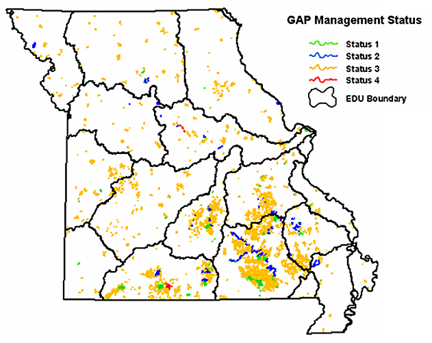
Appendix F. A map of stream segments flowing through public land categorized by GAP management status. A status of "1" denotes the highest, most permanent level of maintenance, and "4" represents the lowest level of biodiversity management, or status unknown.