Ecological Archives A025-088-A5
Chi Xu, Milena Holmgren, Egbert H. Van Nes, Fernando T. Maestre, Santiago Soliveres, Miguel Berdugo, Sonia Kéfi, Pablo A. Marquet, Sebastian Abades, and Marten Scheffer. 2015. Can we infer plant facilitation from remote sensing? A test across global drylands. Ecological Applications 25:14561462. http://dx.doi.org/10.1890/14-2358.1
Appendix E. Supplementary results from the model.
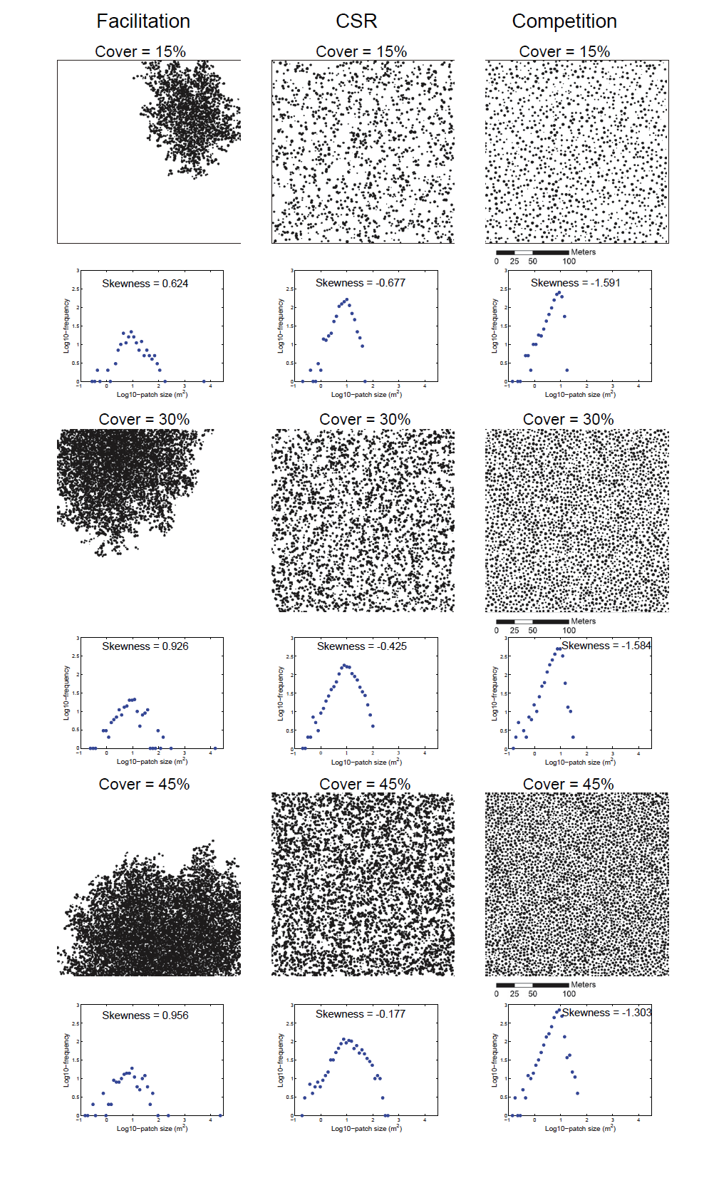
Fig. E1. Examples of spatial patterns and patch-size distribution (with Pearson’s moment coefficient of skewness) generated by the null (complete spatial randomness, CSR) (A), facilitation (B) and competition (C) models at 15%, 30% and 45% vegetation cover.
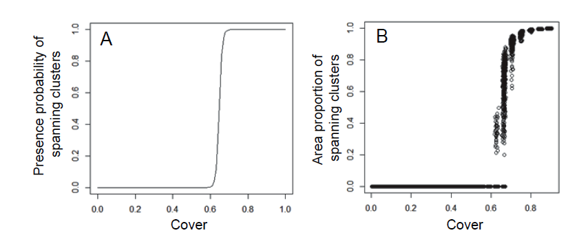
Fig. E2. The probability (A) and area proportion (B) of spanning clusters illustrate that the discontinuity in the skewness patterns around 70% cover is likely associated to the percolation point (Grimmett 1999). The results are generated by the null model assuming spatially random mortality with 200 repeated simulations.
Literature cited
Grimmett, G. 1999. Percolation. Second Edition. Springer Verlag.