Ecological Archives A025-064-A2
Michael Dorman, Tal Svoray, Avi Perevolotsky, Yitzhak Moshe, and Dimitrios Sarris. 2015. What determines tree mortality in dry environments? A multiperspective approach. Ecological Applications 25:10541071. http://dx.doi.org/10.1890/14-0698.1
Appendix B. List of Landsat satellite images and derived NDVI maps.
Table B1. List of Landsat-5 TM (L5 TM) and Landsat-7 ETM+ (L7 ETM+) satellite images used in the study. All images were of the 174/038 (path/row) scene location and had zero cloud cover within the studied area.
Year
Satellite
Date
1994
L5 TM
4.10
1995
L5 TM
7.10
1996
L5 TM
23.9
1997
L5 TM
10.9
1998
L5 TM
15.10
1999
L5 TM
2.10
2000
L5 TM
4.10
2001
L7 ETM+
13.9
2002
-
-
2003
L5 TM
11.9
2004
L5 TM
29.9
2005
L5 TM
16.9
2006
L5 TM
19.9
2007
L5 TM
22.9
2008
L5 TM
8.9
2009
L5 TM
27.9
2010
L5 TM
16.10
2011
L5 TM
17.9
2012
L7 ETM+
27.9
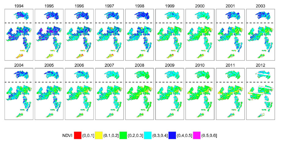
Fig. B1. NDVI in Lahav and Dvira forests in 18 years during the period 1994–2012. Note that an NDVI image for the year 2002 was not available (Table B1). Note that the 2012 image has 22.4% of missing data, due to the Scan Line Corrector (SLC) failure in the Landsat-7 satellite which occurred in 2003.