Ecological Archives A025-017-A1
K. M. Giljohann, M. A. McCarthy, L. T. Kelly, and T. J. Regan. 2015. Choice of biodiversity index drives optimal fire management decisions. Ecological Applications 25:264277. http://dx.doi.org/10.1890/14-0257.1
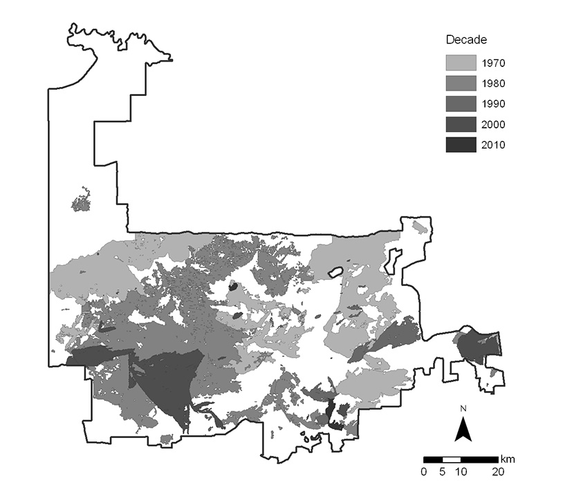
Appendix A. Map of wildfire scars from 1972–2011 within the Murray Sunset National Park.
Fig. A1. Wildfire scars within the Murray Sunset National Park derived from satellite imagery for the years 1972–2011. Conversion of satellite imagery to digital format was undertaken by Avitabile et al. (2013). Wildfires are displayed by decade of occurrence.
Literature cited
Avitabile, S. C., K. E. Callister, L. T. Kelly, A. Haslem, L. Fraser, D. G. Nimmo, S. J. Watson, S. A. Kenny, R. S. Taylor, L. M. Spence-Bailey, A. F. Bennett, and M. F. Clarke. 2013. Landscape and Urban Planning. Landscape and Urban Planning 117:81–91.