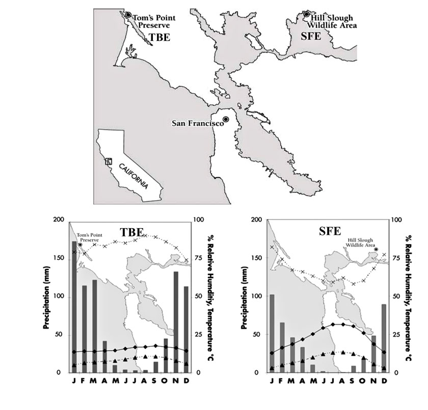
Appendix A. Maps and climate diagrams for study sites.
Map of study sites and climate diagrams for Tom’s Point, Tomales Bay Estuary (TBE), and Hill Slough (SFE). Climate for TBE is represented by 35-year average data from Bodega Marine Laboratory, 20 km north of the study site while 50-year average climate data from Travis Air Force Base, Fairfield 3 km northeast of Hill Slough represents the inland SFE site. Diamond symbols connected by sold lines represent average maximum monthly air temperature, triangle symbols connected by broken lines represent average minimum monthly air temperature, X symbols connected by dashed lines represent mean monthly relative humidity, and bars are mean monthly precipitation.